The Oro Moraine
The Oro Moraine is a gift from the last ice age. It collects, cleans and stores water from rainfall. This water called groundwater is our source of drinking water. Groundwater is water found under the surface, between rocks/sands/ gravel and in aquifers. The moraine holds a huge amount of water in its aquifers; more recent rainfall is found in its higher aquifers, whereas water that is hundreds to thousands of years old lie in deeper aquifers. The moraine supplies everyone in Oro-Medonte and in other areas of Simcoe County with clean, cold drinking water.
The Oro Moraine is also thought to be the main recharge area for water and wastewater for the Minesing Swamp, a 7000 hectares reserve that has been categorized as “a world-class resource of international significance”. This swamp is an important resource due to its diverse habitats and its numerous rare plant species. However, many new subdivisions are rapidly being built in the area, and any resulting change to the groundwater system will have a detrimental impact on the Minesing Swamp.
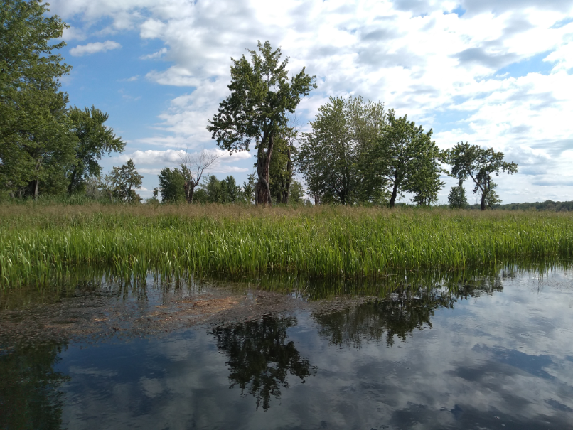
Image from NVCA: Minesing Swamp
We must protect our fragile ecosystems, in addition to wetlands, the moraine is also home to large forest tracts, grasslands and farmlands that provide habitat to many wildlife and/plant species and more. It provides essential wildlife/ecological corridors allowing movement between areas within/outside of the moraine; UNINTERRUPTED CORRIDORS are CRITICAL for many species survival. Fragmentation will only lead to species decline.
It is imperative that we protect BIODIVERSITY and SPECIES AT RISK including ENDANGERED SPECIES that call the Oro Moraine home. Species such as the red-headed woodpecker, whip-poor-will, barn swallow, bobolink, wood thrush, Blanding’s turtle, fox snake and little brown bat are just a few. Urban sprawl, gravel/sand extraction, and more all lead to habitat loss and fragmentation.
As of 2010 (Oro Moraine Report Card from NVCA), approximately 50% of the moraine was forested, and the other 50% was used for farming, aggregate extraction, residential housing, and recreation (such as biking, hiking, golfing and skiing). That was 15 YEARS AGO and MUCH has changed since.
ONCE THE ORO MORAINE IS PAVED OVER, THERE IS NO GOING BACK. Our natural assets will be lost and ecological stability will quickly decline.
The federal government declared a CLIMATE EMERGENCY in June, 2019. 384 jurisdictions in Canada also declared climate emergency, including Barrie, Collingwood, Gravenhurst, Bracebridge and many more locally. Now more than ever we need to save our wetlands and forests that absorb carbon and pollutants, provide oxygen, and protect us from flooding and major natural disasters.
Image from NVCA Oro Moraine Report Card 2010
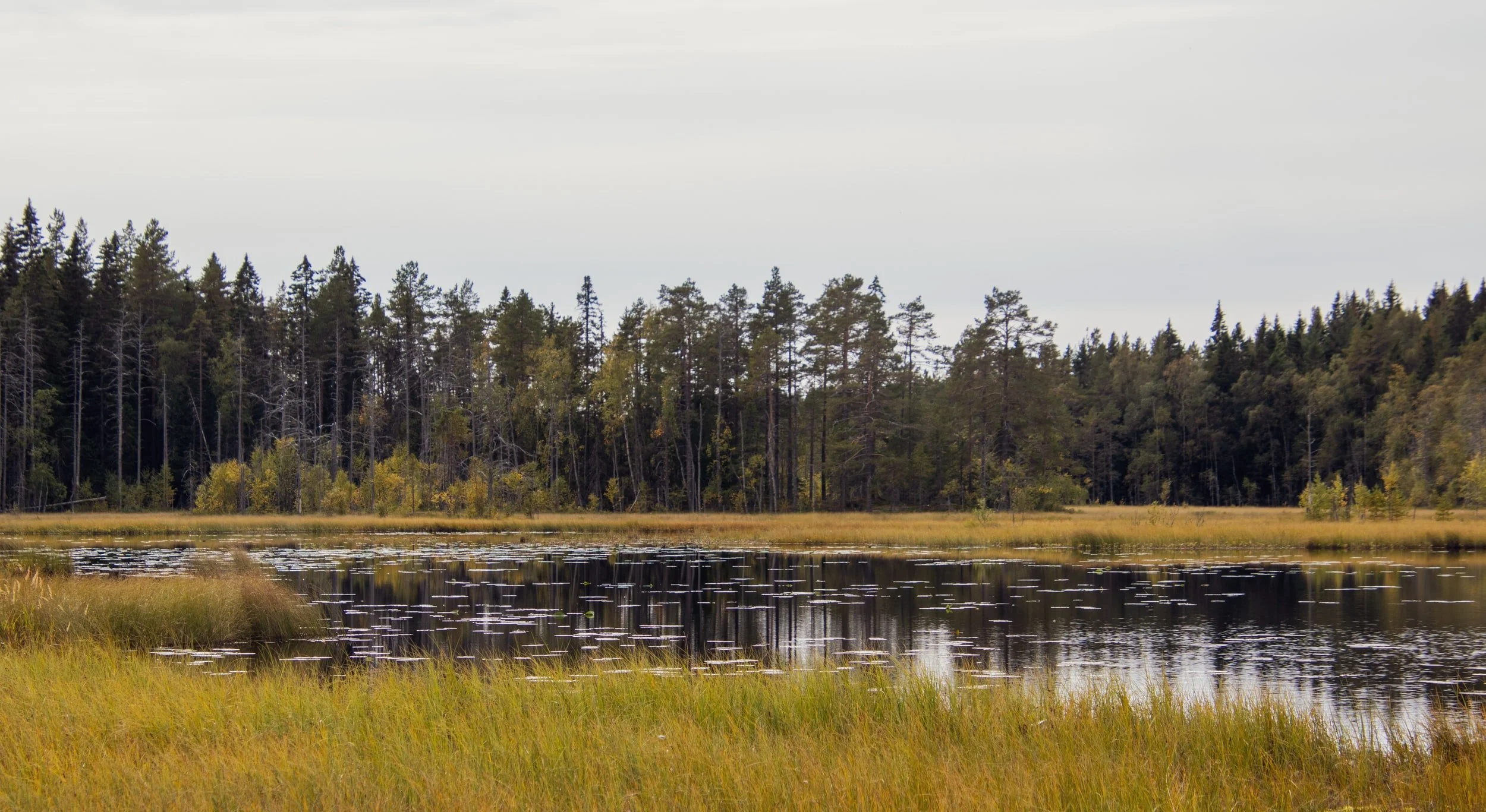
Without wetlands, the effects of climate change become more prominent; as wetlands decrease, the chances of flooding and droughts increase. As well, this moraine is involved in the crucial process of filtering the water that enters these wetlands through underground aquifers that act like a sponge to remove harmful particles from the water. The moraine is an essential recharge/discharge/storage area for rainwater and serves to replenish the groundwater system for the water supply for ALL of Oro Medonte and into Simcoe County.
Image from NVCA Oro Moraine Report Card 2010
Within the Oro Moraine, there are thick layers of sands and gravel which are separated by silt/clay aquitards. These layers form distinct aquifers, as seen in the image above. The Upper Aquifer is continuous throughout the Oro Moraine, and areas, where the Upper Aquifer is most prominent, are highly sensitive to local changes in infiltration and are therefore easily affected by a local loss of recharge through residential and industrial development. The Upper Aquifer is also associated with the deep water table, which is where water lies deep below the ground surface. The water from this area is the main supply for the groundwater that provides a consistent flow of cool water to the headwaters of cold water streams. The Regional Aquifer seen in the photo is the main source for municipal and private wells and is fairly continuous throughout the moraine. The Lower Drift and Basal aquifers are deep aquifers that are less continuous in the moraine.
The Oro Moraine is under threat from developers and the extraction of its natural resources. The township of Oro Medonte plans to develop areas such as Horseshoe Valley, Craighurst, and Sugarbush. Horseshoe Valley is a very important recharge area on the moraine. There are also significant wildlife/ecological corridors in these parts of the Oro Moraine. These corridors allow movement between areas within and outside of the moraine and are essential for species’ survival. With each development there is more fragmentation which will destroy wildlife/ecological corridors that are ESSENTIAL for many species survival including endangered and species at risk. The integrity of the moraine as a natural area is also becoming threatened by sand and gravel extraction (currently over 20 pits), bottled water extraction, rural development, and the use of land for recreational activities such as skiing and golf.
It is imperative that we protect biodiversity and species at risk that call the Oro Moraine home. In order to do this, we must protect the Oro Moraine as it provides habitats to such plants and animals that are becoming increasingly rare in Central Ontario. As well, the moraine provides residents throughout Simcoe County and beyond with clean water and rich agricultural land, and helps limit flooding and the effects of natural disasters. This important natural resource must be protected for future generations.
According to a study from the University of Waterloo; the development of and extraction of gravel from the Oro Moraine may cause serious damage to the present aquifers, disrupting the water flow/recharge/storage process within the moraine. This will cause further degradation to the wetlands that rely on the water flow from the moraine, such as the Copeland Forest/Wetland, Bass Lake, Hawkestone Wetland Complex, Minesing Wetland and many more.
As these smaller rivers and creeks flow down from the moraine they feed/sustain many wetlands. Many are provincially significant including Copeland Forest, Bass Lake, and many more. Copeland Forest is a 4,400 acre nature preserve and is an Area of Natural and Scientific Interest (ANSI). It has the highest biodiversity in Simcoe County and is the largest upland forest south of Algonquin Park.
FACT: 80% of wetlands in southern Ontario have been destroyed; we can’t afford to lose anymore.
The topography map to the left illustrates the elevations in Simcoe County. The Oro Moraine can be seen on the upper right (brown area), having the highest elevations (along with the Niagara Escarpment to the bottom left). Groundwater discharge seeps out from the moraine in the form of natural springs, creeks and streams and flow downhill forming rivers and streams. Coldwater streams such as the Coldwater River support brook trout and other sensitive cold water species.
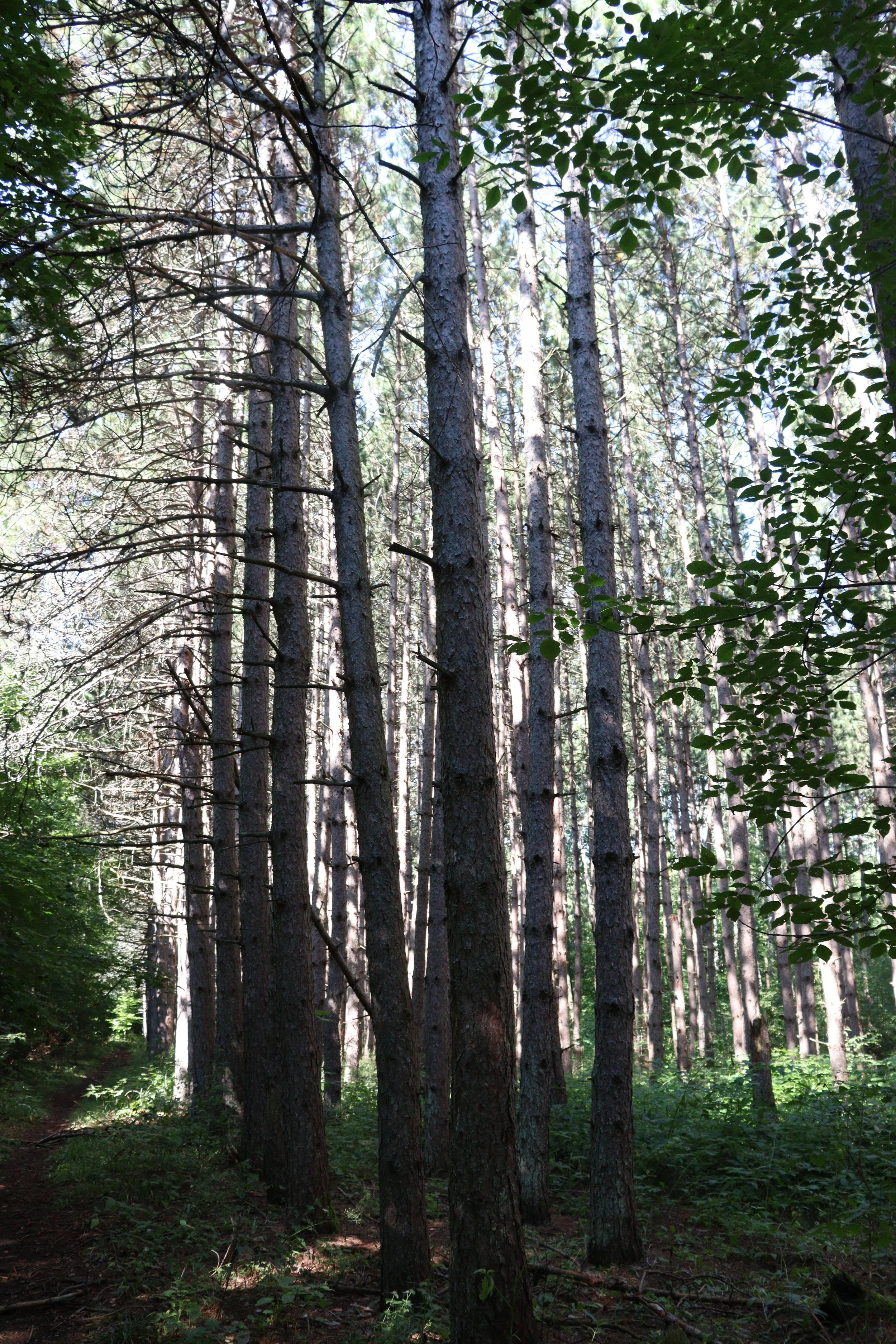
Copeland Forest
Map of Conservation Authority Areas directly connected to the Oro Moraine, from Drinking Water Source Protection (South Georgian Bay Region)

Taken from www.raog.ca/climate-emergency