The Oro Moraine is Outlined in grey. The map shows the various rivers and streams that start from the Oro Moraine (Image from NVCA (Nottawasaga Valley Conservation Authority) Oro Moraine Report Card 2010):
Map showing the main rivers, streams, and wetlands coming from the Oro Moraine (Lake Simcoe watershed section), highlighted in orange (Image from LSRCA Oro and Hawkestone Creeks Subwatershed Plan 2013):
Topography map showing elevations in Simcoe County (Image from the NVCA Annual Report): Note the Oro Moraine in Upper Right.
In 2017/18, the Previous Provincial Government planned to expand the Greenbelt into Simcoe County and other areas of Ontario (Map From Environmental Defense):
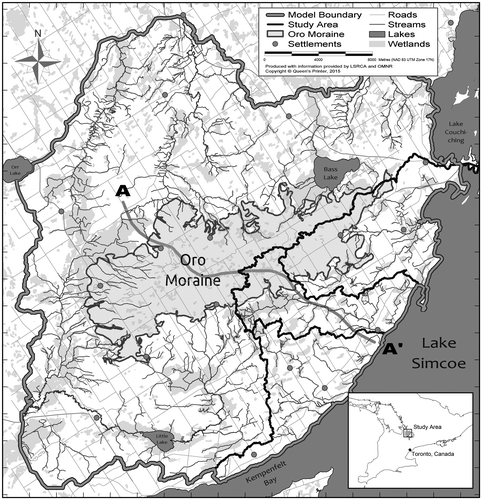
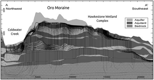
Show ection A–A’ on map to the left; illustrating the hydrostratigraphic layers, overlain with forward particle tracks from the Oro Moraine toward surrounding ecological features. Map from a Methodology for Identifying ESGRAs, Study on the Oro Moraine by Mason Marchildon